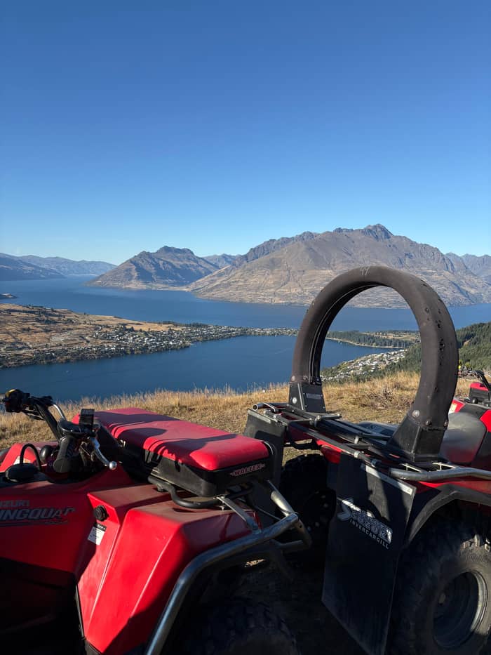
Ride it yourself
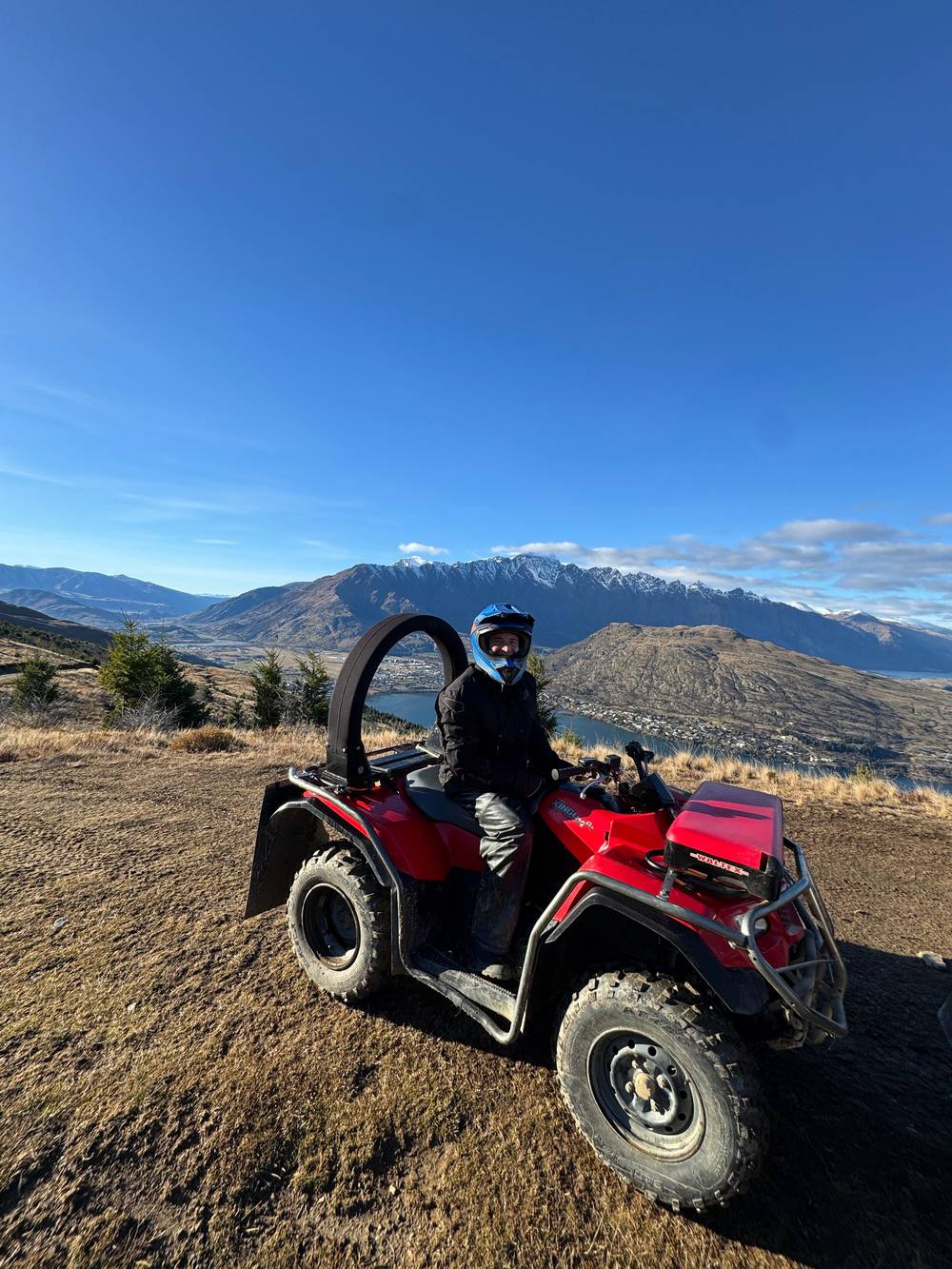
Quad up Queenstown Hill
This site's tour
- Riding2.25 hours
- LandWorking sheep station
- TopSummit stop
Price it for your group
Quad ride on Queenstown Hill, about 2.25 hours riding
★ 4.9 · Rated by 506 guests
Review 3 options
Enter your group size to compare what each way up costs.
≈
View≈
View≈
ViewCurrency conversion uses the ECB reference rate on GetYourGuide from-prices. The exact price is displayed when you book.
A Queenstown quad bike adventure climbs through a landscape with a long story: ice that carved the lake, peaks named by settlers, a gold rush in the rivers and sheep stations on the slopes. Here it is, as you see it.
Editorial team, queenstownquadbike.quest · Updated November 8, 2026 · A 7 min read
Summary view
Every view on a Queenstown quad bike adventure is a view of what ice left behind. Destination Queenstown, the regional tourism body, explains that Lake Whakatipu was formed by a huge glacier pushing through from the north-west as the last ice age ended, 15,000 years ago.1 Tourism New Zealand says the lake fills a deep valley that ancient glaciers carved into the mountains.6
The result is a long, narrow lake bent into the shape of a lightning bolt. It covers 290 square km, runs 84km and is 5km wide at its widest point.2 From the top of Queenstown Hill you see only part of it, curling away behind Cecil Peak and towards Kingston, and that is the best way to sense its scale: the water simply keeps going.
The slopes you ride are the sides of that old ice trough. Steep faces drop straight into the water, and the softer, rolling ground around Frankton and the hill is where the ice spread out and left its debris. On mountain quad biking in Queenstown you ride up those slopes on farm tracks and look down on the floor of the old glacier, now filled with the lake.
Names in the landscape
| Place | What it is | Its story |
|---|---|---|
| The Remarkables | Range across the lake | Named by Alexander Garvie |
| Cecil Peak | Mountain facing town | Named for Rees's son |
| Walter Peak | Mountain facing town | Same son, Cecil Walter |
| Mount Earnslaw | Highest peak by the lake | Far end, north-west |
| Shotover River | River north of town | Named after an English estate |
| Coronet Peak | Ski field to the north | Opened commercially |
Names and stories as Destination Queenstown and Tourism New Zealand tell them.7,19,17,20,11
Lake Whakatipu carries a Māori name that Destination Queenstown translates as the hollow of the sleeping giant.12 Tourism New Zealand adds a curious fact: because of its shape, the water rises and falls about 10 centimetres every 25 minutes or so, a standing wave known as a seiche.13 The old stories connect that rhythm to the giant beneath the water.
The people who knew this country first were Ngāi Tahu. Destination Queenstown writes that they made their home in the South Island over 800 years ago, drawn to the head of the lake by seasonal hunting and by pounamu, the prized greenstone.3 They also gathered tikumu, the mountain daisy, for cloaks, and fragrant oil from taramea on the snowlines.14
This is living heritage, not a museum story, and the respectful way to meet it is through what the iwi and official bodies choose to share. Tourism New Zealand gives the summit of Queenstown Hill as Te Tapu-nui and translates it as mountain of intense sacredness.15 Keep that in mind as you stand near the top and look over the water.
The first European to see the lake was Nathaniel Chalmers in 1853, according to Destination Queenstown.26 A few years later, in 1857, Alexander Garvie saw a jagged range during a survey and called it the Remarkables.7 The name stuck, and the range now looks back at you from across the lake on every clear day.
William Rees, often called the founder of Queenstown, arrived in 1860 and set up a high-country farm close to where the town centre stands today.8 Cecil Peak and Walter Peak, the pair of mountains facing the town, both take their names from his son, Cecil Walter.19 Rees also named the Shotover River after Shotover Park, the English home of his business partner.20
The tallest mountain around the lake is Mount Earnslaw, at 2819 metres.17 You will not see it from every bend, but on a clear day it marks the far end of the view to the north-west. Rees left a vivid account of the way in: he wrote of speargrass and matagouri so thick that they tore at the party's legs.25 Look at the tussock on the hill and imagine crossing it on foot.
What draws you
Pick what you came for, and the right way up follows.
If I want the summit view and to ride myself
The Queenstown Hill quad tour
If I love the films
A 4WD half-day tour
Middle-earth settings are all around the basin.22
If I want the gold-rush story
Arrowtown after your ride
The Chinese settlement sits by Bush Creek in Arrowtown.23
If I prefer to walk
The Time Walk
A free climb of 2 - 3 hours return to the Basket of Dreams.24
Three ways in
Ride it yourself
This site's tour
Film locations
Sit back, listen
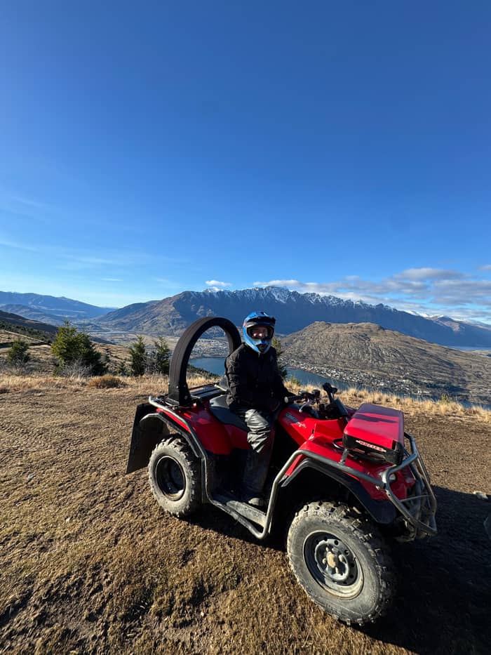
Another valley
Wanaka side
The high country changed overnight when gold was found. Jack Tewa made the first strike in 1862 by the Arrow River.4 Within months a pair of Rees's farmhands, Thomas Arthur and Harry Redfern, took 9 ounces of gold near where the Shotover and Kawarau rivers meet, at the claim they called Arthur's Point.33 Rees and his neighbour had settled on top of what became Otago's biggest goldfield.34
Boom towns rose fast and died almost as quickly. Destination Queenstown names Skippers and Macetown as the best-known of the settlements that turned into ghost towns when the gold ran out.35 From the hill you can see the gorges where the miners worked, and the river valleys that still hold the old tracks.
Chinese miners shaped this story too. They played a big part in Arrowtown's history after 1869, invited to fill gaps left by European miners who had gone to the West Coast.36 The Department of Conservation records fewer than 200 Chinese miners in Otago in 1866 but 3564 Chinese in Otago by the 1874 census, most of them on the goldfields.37 Their partly restored settlement stands beside Bush Creek in Arrowtown.23
Map
The first panel shows where the quad tracks are and where you are picked up; the second shows the peaks you see from the top.
View 12 stops
Pick a route and tap a pin or a stop: you get its note and a Google Maps link.
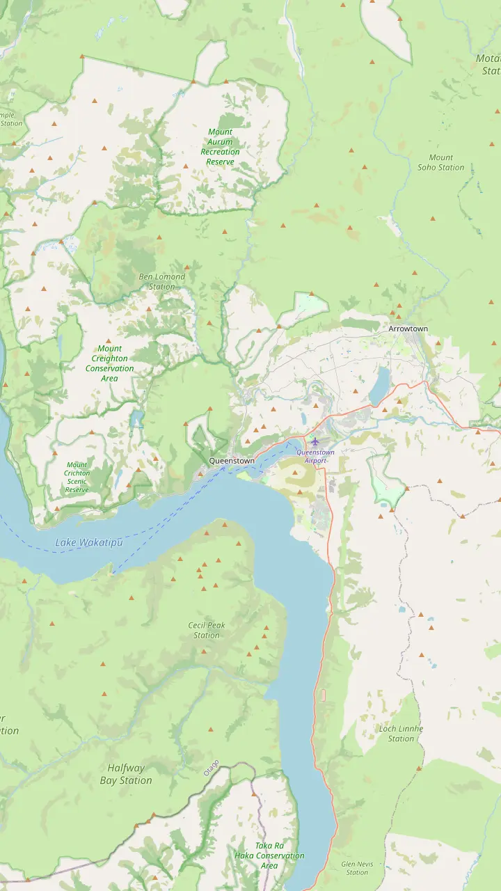
The summit, just under 1000 metres, where most quad tours stop for a hot drink and the 360° view.
Google MapsOpened in 1947 as the South Island's first commercial ski field.
Google MapsThe range across the lake, named by Alexander Garvie in 1857.
Google MapsOne of the pair of mountains facing the town, at 1980m.
Google MapsCecil Peak's partner across the water, at 1800m.
Google MapsInfo & Track at 37 Shotover Street, the main meeting point; town parking is tight.
Google Maps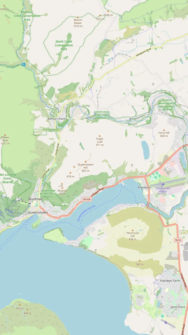
The summit, just under 1000 metres, where most quad tours stop for a hot drink and the 360° view.
Google MapsA working sheep farm of 3500 acres whose private trails the site's quad tour rides.
Google MapsFree parking close to the quad base at 420 Tucker Beach Road, if you tell the operator.
Google MapsAn included pick-up point near Queenstown Airport.
Google MapsInfo & Track at 37 Shotover Street, the main meeting point; town parking is tight.
Google MapsThe sculpture on the public Time Walk, passed on the way to Te Tapu-nui.
Google MapsThe Time Walk starts from a small car park off Belfast Terrace.
Google MapsA small lake below the north-eastern slopes of Queenstown Hill, seen on the ride.
Google MapsMap © OpenStreetMap contributors
The story in the view
15,000 years ago
A glacier shapes the hollow the lake now fills.1
1857
Alexander Garvie names the range on a survey.7
1860
William Rees sets up a high-country farm by the lake.8
1862
Jack Tewa makes the first strike by the Arrow River.4
1912
The Earnslaw starts carrying sheep and passengers to stations.9,10
1947
Coronet Peak opens as a commercial ski field.11
When the gold faded, sheep stayed. The quads on this site ride across Queenstown Hill Station, which is still a working sheep farm.5 That puts a quad bike safari in Queenstown in the middle of a long farming tradition: the same slopes, the same fences, and stock that the operator warns may act unpredictably.38
The lake itself was once the road to the stations. The steamship Earnslaw began service in 1912.9 It was built to move sheep, cattle and passengers between the high-country stations around the shore.10 Today it carries visitors across to Walter Peak High Country Farm for farm demonstrations and afternoon tea.39
Life on a station still shows on the ride. You pass woolsheds and stock yards, gates that the guide opens and closes, and sheep scattering ahead of the line. The operator even ends its corporate conservation days with lunch at the station woolshed.40 Ride slowly past the animals: it is their home, and you are a passing visitor on their hill.
Video
Toitū Otago Settlers Museum on YouTube · Playback files load only once you tap play.
Speargrass, often more than three feet high, and masses of matagouri constantly impeded us, especially in the gullies.
Not every tree on the slopes belongs. The operator of the site's tour calls wilding pines one of the most aggressive exotic species brought by settlers.41 It runs volunteer days on Queenstown Hill Station to pull them up.42 On the public side of the hill, the council says wilding conifers have spread across its reserve for 60+ years.43
The council's answer is a long-term restoration plan for Te Tapunui, adopted on 4 September 2025.44 It sets out three planting zones: native trees, a mix of native and exotic trees, and grey tussock with shrubland species.45 In good conditions, it says, native mountain beech and exotic redwood can grow 3 to 5 metres within five years.46
From a quad you see both landscapes side by side: dark stands of conifer on one face, and on another the gold-brown tussock that the first farmers knew. Autumn adds red and gold to the poplars and willows in the valleys below, one of the four seasons Tourism New Zealand singles out for Queenstown.47 Each season changes the colour of the same ride.
A quad is the most hands-on way up. The site's tour gives you about 2.25 hours on your own machine on Queenstown Hill, climbing to the summit.21,18 For travellers who would rather sit and listen, a half-day 4WD tour from Queenstown runs 4 hours in a vehicle limited to 6 people. Tourism New Zealand points out that Lord of the Rings fans will spot many Middle-earth settings in this landscape.22
If you want the summit without an engine, the Queenstown Hill Time Walk is free. Destination Queenstown suggests 2 - 3 hours for the return climb.24 It reaches the Basket of Dreams and the top of Te Tapu-nui from the town side.31 Combine it with the quad ride on another day and you will know the hill from both faces.
Further afield, the Cardrona Valley quad tour rides the Wanaka side of the mountains. Arrowtown, the gold town, is close enough for an afternoon visit after a morning ride, with the Chinese settlement at the top of its main street.23 However you go, choose a clear day if you can: the high country is about the view.
FAQ
It is 5km wide at its widest point.2
He saw the range during a survey of the district and gave it the name.7
Jack Tewa made the first strike by the Arrow River.4
Queenstown Hill Station is a 3500-acre working sheep farm.5
That is the translation Tourism New Zealand gives for the summit of Queenstown Hill.15
The conifers have spread through the council's reserve on the hill for 60+ years, it says.43
Sources
Further reading
Not sure a quad ride above Queenstown suits you? A real person answers here.